Objectives
Development of machine and deep learning algorithms for the identification of high-density crops in images acquired with UAVs:
1. Segmentation of row canopies
2. Detection of rows and planting defects
3. Counting and geolocation of individual plants
In order to improve strategies and decisions regarding treatments, irrigation, health status, and yield production.


UAV Technologies
Simple, low-cost, and high-quality mapping of orchards
- RGB
- Multi-/Hyper-spectral
- Thermal
- LiDAR
AI for Precision Farming
In precision farming, AI simplifies complex tasks with straightforward inputs and outputs, streamlining agricultural processes. A simple input, such as real-time data from sensors or drones, is fed into AI algorithms. These algorithms swiftly analyze the information, considering factors like soil conditions, crop health, and weather patterns. The output is a precise and actionable recommendation for farmers, guiding irrigation, fertilization, or pest control decisions. This streamlined approach enhances efficiency and allows farmers to make data-driven choices for optimal crop management, ultimately improving yields and sustainability in agriculture.

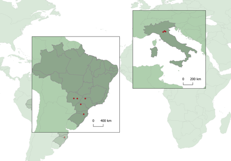
Test Sites
Test sites serve as crucial spaces for experimentation, validation, and real-world testing across various domains. Whether in technology, agriculture, or research, these dedicated locations provide a controlled environment to assess new methodologies, technologies, or innovations.

Italian Test Sites:
➢Cultivations: Apples/Pears
➢Resolution: 3 cm/pix
➢Task: Segmentation

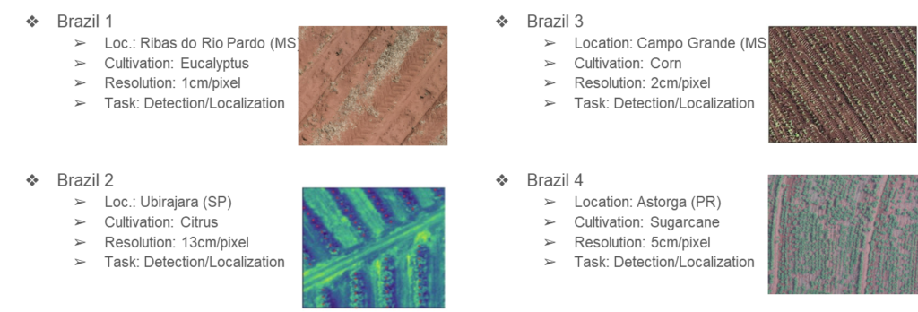
Brazilian Test Sites

Examples of Developed AI Architectures

